Dr. Scott Chaussée
I am a landscape archaeologist specialising in marine and near-surface geophysical prospection. My PhD and ongoing research focuses on the transitional Roman to early medieval landscape and territorial identity in southern England, namely the Kingdom of Sussex. I have worked on fieldwork projects across the UK and the MENA region, namely Morocco, Oman, and the UAE. I hold a PhD from University College London and currently work as a marine geophysics consultant at Wessex Archaeology.
This site documents my portfolio of survey work — including terrestrial geophysics, UAV orthomosaics and photogrammetry, R stats, and integrated methodologies. I am always open to research collaborations and discussions.
Research & survey methods
✈️ Aerial prospection
UAV‑based photographic survey, orthomosaic generation, and structure‑from‑motion photogrammetry for archaeological feature recording and landscape analysis.
Examples of aerial work →📡 Ground‑penetrating radar
Subsurface imaging using 200–500 MHz antenna arrays. Processing and interpretation for archaeological features, burial detection, and stratigraphic analysis.
GPR case studies →🧲 Magnetometry
Fluxgate gradiometer survey for detecting archaeological features including enclosures, kilns, and industrial activity.
Magnetometry examples →🔍 Integrated approaches
Combining aerial and subsurface datasets within GIS to develop comprehensive interpretations of complex archaeological landscapes.
Integrated projects →Selected survey projects
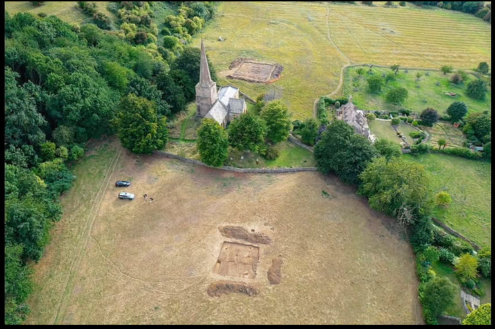
UAV survey
Orthomosaic and DEM of Roman and early medieval earthworks. Undertaken for the 'Where Power Lies' project at Newcastle University.

UAV multispectral survey
Multispectral survey of the intertidal zone near Portchester Castle, Hampshire. Flown in support of a dissertation project at the University of Winchester.
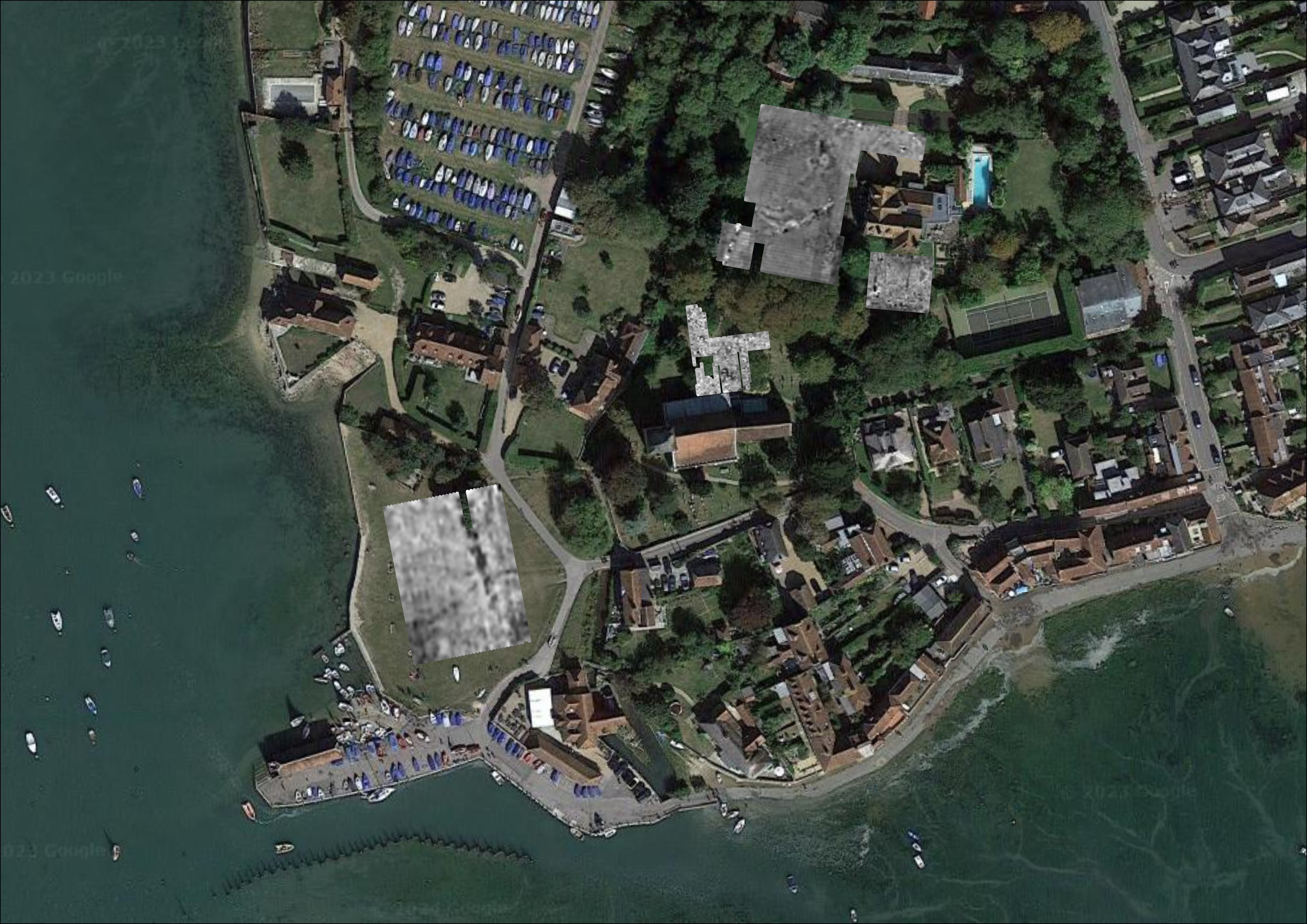
GPR survey
GPR survey revealing buried wall of a medieval building, possibly the hall of King Harold II Godwinsson. Undertaken for the 'Where Power Lies' project at Newcastle University.
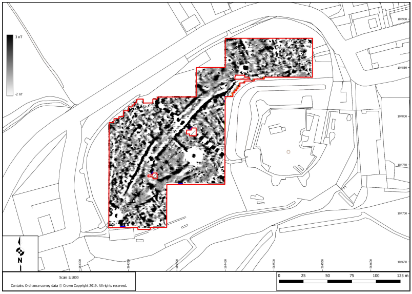
Gradiometry survey
Gradiometry survey revealing internal organisation of the medieval borough. Funded by the International Society for Archaeological Prospection